Friday, June 28, 2013

Final thoughts from the tundra...


It has been a long, but productive and enjoyable trip to Alaska. In the last 10 days, we've landed in Prudhoe Bay and driven south on the Dalton Highway; we've learned about the Toolik Lake field station in Interior Alaska and benefited from insights from our NSF-sponsored colleagues; we've flown beyond the Arctic Circle and worked in Barrow on the North Slope; and we've conducted field research outside of Nome on the Seward Peninsula. That covers a tremendous north-south gradient in latitudes and reinforces the great diversity of terrestrial ecosystems in Alaska.

Experiencing that diversity first-hand and in a timeframe that spans slightly more than a week emphasizes the many challenges we face in modeling important feedbacks between Arctic ecosystems and climate. We must take measurements to inform models of current climates and also do so such that we can represent model-based predictions of future climates. This is not be easy undertaking, but it is an important one if we are to improve climate simulations and potential impacts of future climates on what we believe are globally important, sensitive, and poorly understood high-latitude ecosystems. This is both the challenge and the opportunity being tackled by the NGEE Arctic team.

As we depart Anchorage, bound for Knoxville, I upload the following pictures for what has been a rewarding trip to Alaska. My thanks to Rich, Dan, Guido, Victoria, Santonu, and Jenny; we had our share of long days and late nights. By the way, I'll be back in Barrow in two weeks; keep an eye out and an ear open for more thoughts from the tundra...


Third day is a charm...


Our first two days in Nome consisted of warm temperatures and clear skies. Today's forecast shows no change in temperature, but a possible chance of rain in the afternoon. Weather in Alaska, particularly along the coast, is hard to predict so we left Nome prepared for whatever conditions Mother Nature had in store for us. We knew that mosquitoes would be part of the forecast, that we could definitely count on!

Our group got together last night and looked over a series of satellite images that Santonu had prepared and brought with him. After some discussion, it was decided that we would visit a more recent drained thaw lake basin along the Kougarok Road. The lake basins we worked at earlier in the week were, according to Guido, several thousand years old. The basin that we had picked out for today was much younger; in aerial images it showed up as a wetland in the 1950s, a lake in the 1970's, and then drained just within the last 5 years. This meant that it was a good analog for what might be expected in a changing climate. That is, a landscape in transition at time scales relevant for inclusion in climate models. 


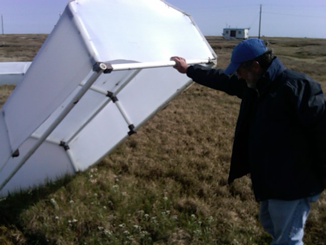
We arrived at the site mid-morning and went about our routine. Jenny and Guido quickly set up the GPS base station, while the rest of us walked a short distance across the tundra to the basin of interest. What we found was a basin 150 to 200 meters in diameter. The basin was 5 to 10 meters below that of the surrounding tundra. Guido mentioned that the lake most likely drained when the down-slope rim for the basin was breached by high water and set-up conditions favorable for thermal erosion. Indeed, when we walked down to that area, there was strong evidence of a deep thermal gully running out into the tundra. The basin itself was dotted with small ponds several meters in diameter and large rounded mounds that were rich in peat. These mounds were exceptionally dry and plant mortality was severe. In some cases, large areas were completely lacking live vegetation. This was similar to what we see in terms of vegetation dynamics on high-centered polygons in Barrow.


As we had in previous days ,we laid out transects and began collecting data. Guido was curious about the ponds within this basin and started mapping their location. Although polygonal structures within the basin were only weakly visible, the ponds to my eye were mostly in trough intersections. Guido probed a little to determine their depth and they were maybe on average a meter deep. However, in one there was a much deeper area that ran lengthwise across the pond, leading Guido to speculate that this could be an area were the underlying ice-wedge had melted. In some cases the water was actively running through these areas and in others the ponds were static. In the latter case, the water was 13 to 15C, warm enough to certainly contribute to a deepening or expansion of these ponds. The surface and subsurface interactions are undoubtedly strong in these young and changing drained thaw lake basins. Since our team has such a good geophysical characterization capability, this is something that we are interested in pursuing further.


Having worked hard, we left the field today very satisfied with what we had seen and accomplished. It did rain, but not enough to stop our work for very long. The topic of discussion over dinner was whether we could locate any more of the young basins along either the Kougarok or Council Roads out of Nome. Guido, Dan, and Santonu were going to take a more extensive look at their maps and see. Last year, we saw small drained lake basins out the road to Council and Larry Hinzman, Chief Scientist for the NGEE Arctic project, has studied several "disappearing lakes" in this region over the last decade. Whether these lakes drain due to surface water drainage in continuous permafrost like the one we saw today or more subtle connection to groundwater in areas of discontinuous permafrost like Council would be an interesting research question. If such features become more prevalent in the future because of regional warming, then they represent processes that could be incorporated into climate models for improved predictions. This is, of course, the goal of our project.

Thursday, June 27, 2013

A second day out Kougarok Road...

This morning we drove back out the Kougarok Road to begin our day. The drive was not as long as yesterday; we reached our destination after 64 miles. According to Guido, this was his Site 5 and it also represented a drained lake basin similar to the one we previously worked at further down the road. This feature, however, was smaller with a more abrupt transition from upland to basin. The transition area was dense with woody shrubs, while the basin was wet and contained a variety of sedges and grasses.

Guido established this site not too long ago and, unlike the other sites, this one is instrumented with a tripod-mounted weather station where air and soil temperatures are monitored, along with radiation and relative humidity. Data is logged, stored, and then uploaded via a satellite weekly. There is also a 4.5 meter borehole nearby that allows an accurate record of temperatures below-ground to be obtained. This is important when working in these environments. In looking at this installation, one cannot help but see that all wires and cables are housed within flexible conduit. This protects the cables from being chewed on by rodents and foxes. Damage like this can be a big problem for remote instrument locations, and we have experienced instrument failures in Barrow for just this reason.


Once we got our bearings and examined the general area, we laid out transects like yesterday. We had a good routine and everyone knew their job. Victoria set up vegetation plots and conducted plant composition surveys; Jenny and Santonu started gathering data with the ASD specroradiometer; Guido and Dan marked all locations with dGPS; and Rich and I harvested the vegetation plots. Harvesting the small plots was a little harder than it was yesterday thanks in large part to the presence of woody shrubs, mostly Betula.


One thing that was new today was our goal of inserting ion exchange resins into the soil to get a sense for nutrient availability in the various areas along the transect. Rich and Victoria have used a commercial "Plant Root Simulator" or PRS probe for this purpose last year in Barrow with good results and wanted to try them at Site 5 as well. The PRS probes comes with a membrane that contains either an anion or cation exchange resin. Probes are installed in the ground, you then can come back in several months and remove them for analysis. You can specify the nutrients to be analyzed, but we will certainly want estimates of NO3- and NH4+ availability. We will be back later in the summer to recover these probes.


Our trips out the Kougarok Road required us to stop this morning at the Bonanza Express for fuel. Because gas is brought in on barges each year the price of fuel in Nome is generally high. Gas in Barrow is also expensive; slightly more on average than Nome.


Wednesday, June 26, 2013

Out of Nome on the Kougarok Road...


Rich, Victoria, Jenny, and I arrived in Nome yesterday after a short flight from Anchorage. We gathered up our luggage, flagged down a taxi, and made our way several miles out of town to housing that Rich had arranged for us at "Dredge No. 7". The name echoes back to the gold mining days of the early 1990's when miners would use mechanized dredges to search for gold in the streams and small rivers around this area of the Seward Peninsula. That gold rush continues today in the Horton Sound (Bering Sea) where floating "dredges" literally vacuum gold from the sea floor. The influx of modern-day miners is making it difficult to find housing in Nome.


We had traveled to Nome to work with colleagues from the Oak Ridge National Laboratory and University of Alaska Fairbanks. Our goal was to conduct a series of surveys across thermokarst formations, thaw slumps, and much like we did in Barrow, drained thaw lake basins. We met up with Dan, Santonu, and Guido shortly after breakfast and made our way out of town on the Koukarok Road. This is one of three roads leading out of Nome. The road is dotted with summer cabins and used mostly by bird watchers who frequent this area throughout the season. It is also a favorite road for scientists like us who want quick access to the tundra for studies in both continuous and discontinuous permafrost ecosystems


Our drive out the Kougarok Road was about two hours and ended at mile marker 82. We quickly located the drained thaw lake basin that Dan and Guido wanted to study and laid out a transect that went from surrounding tundra, down what would have been the original lake bank, and then across the basin itself. Dan and Guido identified this basin from remote sensing images and we wanted to examine spectral images in the field and then relate those to the remote imagery they had some satellites. The ultimate goal was to identify properties on the ground like species composition and standing biomass that might relate field-scale observations to those from satellite images, and use that to inform ecosystem and climate models.

Once transects were laid out, Santonu and Jenny collected spectral signatures of several plots of different sizes using a back-pack mounted ASD spectroradiometer. This instrument collects data across a wide range of wavelengths and allows researchers to compare ground-based measurements to remote imagery of the type collected by NASA satellites. By the end of the day, Jenny and Santonu had worked out a good routine for capturing spectral information; I look forward to seeing the data, especially how it varies across species composition.


While Jenny and Santonu collected spectral data with the ASD system, the rest of us gathered other kinds of data. Victoria determined species composition for the various plots; Rich measured thaw depth, soil temperature, and water content; and Dan and I clipped plots for standing biomass. Guido has a long history of conducting research in drained lake basins and wanted to know something about permafrost characteristics and depth of organic matter. He worked hard to obtain one soil core from an upland location and one from the basin itself. He used a SIPRE coring device and a hand-held motor. We were able to extract an intact core down to 1.8 meters for the basin area. This core was rich in peat throughout the entire length of the sample.


It was a good first day and we accomplished a lot. Given the long drive out the Kougarok Road we were also able to see a lot of scenery and wildlife; several moose and their calves; a Peregrine falcon and its nest; fish for various kinds (including Grayling) as we crossed numerous bridges along the road; and then a diversity of wild flowers.

 
We should be back at the "Dredge No. 7" before too long. It's been a long, but productive  day. Tomorrow we will be back out the Kougarok Road collecting more data.


Tuesday, June 25, 2013

A walk across a drained thaw lake basin...


Participants in the NGEE Arctic project are interested in better understanding feedbacks between ecosystems and climate. These feedbacks, both negative and positive, can arise through changes in the flux of CO2  and methane to and from the atmosphere. One of the factors that drive carbon cycle processes in the Arctic is the distribution of water across the landscape. Our team began exploring this dynamic last year across a series of inter-connected low- and high-centered polygons on the BEO. Those studies are going well and we have made significant progress in gathering the process knowledge required to inform a range of models from the individual polygon to climate grid cells.

Another important feature of Arctic landscapes that drives carbon, water, and energy-related dynamics is the presence of drained thaw lake basins (DTLBs) across the coastal plain. These occupy a large portion of the land surface and are known to be of various ages (e.g., young to ancient), each with unique soil and vegetation characteristics. The NGEE Arctic project will begin to study these this year in an area just south of the BEO. We laid out transects using LiDAR data, courtesy of Craig Tweedie, and a site visit in April. However, we had not seen this area in a snow-free condition. That was our goal today.

Rich, Victoria, Bryan, Gus, and I drove along the west edge of the BEO before turning east and then south again on a road that goes to the gravel pit. We stopped just before the entrance to the gravel pit and headed across the tundra to our west. Our map, an original product of Ken Hinkel at the University of Cincinnati and his colleagues, showed that we would walk first across an old DTLB and then up and over a slight ridge to a DTLB that was considerably younger. The old DTLB was wetter, polygons were filled with water, and in some areas were beginning to coalesce into larger bodies of water. Gus confirmed that this was a feature of the admittedly poorly understood life cycle of DTLBs. By comparison, the younger DTLB had a quite different composition of vegetation and lacked any well-define polygonal structure or ponding water.


Our team will lay out a sampling transect across this area and begin a series of measurement campaigns in early July. Our goal is to assess CO2 and methane exchange, and energy budgets, across the various DTLBs and relate those potential differences to soil water content, degree of inundation, soil temperature, and vegetation. All this information will be useful as we add new insights about landscape feedbacks to climate models.

Monday, June 24, 2013

Friday flashbacks...


One of the unanticipated benefits of having Gus Shaver visit Barrow and interact with our NGEE Arctic team is the fact that he worked here in the early- to mid-1970's. Gus has conducted a lot of interesting, excellent research in his career.  He started working in the Arctic as a young scientist with the International Biological Program (IBP). The IBP was a large, multi-investigator effort between 1964 and 1974 which coordinated large-scale ecological and environmental studies. One early aspect of work that Gus enjoyed as part of the IBP team, and for which he is well known, was his characterization of roots in various arctic plant species. This research took place just south of Barrow. Our team has driven past this site many times on the way to the Barrow Environmental Observatory (BEO) and we had never stopped. Today, we pulled off the road at a place Gus recommended and walked a short distance onto the tundra. As Rich, Victoria, Gus, and I walked, Gus talked about his research. He pointed out the location of several experiments and mentioned the changes that had taken place in the landscape over the last 45 years. He talked about the stream that ran through this area and how in the 1970's he had examined exposed ice wedges along the stream bank. The stream now is wider than he remembered with steeper, more degraded embankments.

As we walked, Gus began looking for what he called "root boxes". These were boxes have wooden sides with plastic front and backs. Tundra vegetation was excavated, placed carefully into these boxes, and inserted back into the soil. The idea was that the wooden boxes could be periodically removed and the growth of roots examined through the clear plastic windows. After some looking, we found one, then two, and before long we had located his original plots. The thermocouples that had been inserted into each box were still visible. Victoria was particularly keen to talk to Gus about this work. It was agreed that although a simple approach, the data that came from those wooden boxes is still some of the most complete information on root growth and structure for plants on the North Slope. Victoria is conducting research on plant roots in polygonal landscapes as part of the NGEE Arctic project and plans to revisit these boxes later in the year and see if any roots can be observed. It is hoped that a better understanding of root traits can improve our description of plant functional types.


We walked back to the van and drove the remaining distance to the BEO parking area. As we walked along the boardwalk, Gus was reminded that the small "greenhouses" in the distance were part of an educational effort that he and others had initiated several years ago. These structures were placed over tundra vegetation and essentially raised the air and soil temperature throughout the season. Teachers from the local elementary, middle, and high schools would bring students out to the site. They would then talk about climate, climate change, and how increased temperatures could potentially impact local vegetation. I participated in one of these tours last fall and these simple structures are a good "show and tell" opportunity for educators. It was also a good local outreach activity for participants in the NGEE Arctic project. Thanks Gus! 


Back in Barrow...

Rich, Gus, and I arrived in Barrow early Thursday evening after a short flight from Prudhoe Bay. Looking out my window on the flight over, it was surprising to see so much ice covering the Arctic Ocean. I had read that the whaling season so far had been a poor one with only a few bowheads harvested during the spring hunt across the villages of the North Slope. In fact, no whales had been harvested in the Barrow community and thus no festivals to celebrate the traditional success of the whaling crews. Sea ice dynamics are complex and it is hard to know what might contribute to so few whales being seen and harvested this year.

Lacy from UMIAQ picked us up at the Barrow airport and within 30 minutes we had received our mandatory safety orientation, issued BEO permits, and keys to our field vehicle for the week. I dropped Rich and Gus off at the ARM Duplex located on the old Naval Arctic Research Laboratory (NARL) site. The DOE has had their Atmospheric Radiation Measurement (ARM) facility in Barrow for many years and BER program manager, Wanda Ferrell, had kindly offered ARM housing to us for this trip. This was ideal for Rich and Gus. I chose to stay with NGEE Arctic scientists in our Boxer Street apartment that was being provided to our team through UMIAQ. This represented a good opportunity to interact with project staff and to hear what had been happening in the last few weeks.


Friday morning the three of us gathered at the ARM facility where we received a briefing on the many instruments that are used as atmospheric scientists learn more about cloud physics and chemistry, and their role in climate. Dan Lucero and Walter Brower, both associated with the ARM program, walked us through the facilities and explained the operation of the instruments. It is a remarkable array of capabilities where measurements are taken, processed, subjected to QA/QC, uploaded to their data portal, and made available to project personnel and others all within a short period of time.
 
Dan and Walter had arranged for us to also visit the NOAA facility just east of Barrow. Matthew Martinsen is the physical science technician for the facility, he and his colleagues collect a wide variety of atmospheric and environmental data throughout the year. Long-term records, including carbon dioxide concentrations, are a hallmark of their efforts. A graphic on the wall showed that Barrow was one of the first locations in the world to reach 400ppm; an ominous distinction. There was also a figure posted on the bulletin board that showed the date of snow melt recorded at the station since 1940. The trend has been for snow melt to occur earlier and earlier in the year. A note pinned next to this figure indicated that date of snow melt for 2013 was June 2 or the 153rd day of the year; more than 2 weeks earlier than in 1940.


Friday, June 21, 2013

Lasting impressions of Toolik Lake


I heard a few stories about Toolik Lake prior to my arrival. However, the nice thing about finally visiting this field research station myself is to develop my own impressions and draw my own conclusions.

I am impressed with the history of Toolik Lake and the quality of research that has come from work conducted here since the 1970's. The people who work here and the students and technical staff who do much of the research are really passionate about their science. The discussions overheard at breakfast and dinner confirm that the focus of everyone is on their work. It seems like a truly cordial and collaborative group with lots of interactions among the various groups that work at Toolik Lake.

I leave you with a series of pictures that present something of the lighter side of Toolik Lake.
 
1.  I have mentioned that the dining hall served really great food. There are also a couple of well-stocked candy shelves. Plenty of fruit is also available. Ample portions, a variety of choices, desserts, and the candy shelves contribute to what I heard referred to as the "Toolik Ten"...it seems that everyone weighs more at the end of the season.


2.  I have never seen "elevated" bathroom facilities. Still not sure about the underlying reason for this, except for the direct delivery of waste to tanks that can be easily transported to disposal facilities in Prudhoe Bay. Cost of waste water disposal is on the order of $1.00 per gallon. Guidance is two showers a week; 2 minutes each. There is also the lake for washing off the dust of the day!


3.  There is a Toolik Lake Health Club. It contacts a dusty treadmill, elliptical, and free weights. It looked like the weights may have been used; not sure about the elliptical and treadmill. The sign on the door reinforced an interesting perspective on exercise during quiet hours.


4.  Mountain bikes could be checked out and used for business and pleasure. I saw a number of students out on bikes as I ran each morning on the roads around camp.

5.  Finally, lot of creative ways to transport research materials to your research site. Boardwalk buggies appeared to be the favorite means of hauling gear.
 
 
We are now on our way to Prudhoe Bay where Rich, Gus, and I will catch a flight to Barrow. We will be there for a couple of days, showing Gus our research site and discussing potential collaboration between our various projects.